The 2022 hurricane season is off to a quiet start, but the tropics seem to have awakened in recent days and are likely to ramp up in September — the peak month for tropical storm activity. Forecasters are still predicting an above-average season, calling for as many as 10 hurricanes and up to five major ones. That would mean greater volatility for energy markets in any year, but the stakes are arguably higher this year than any time in recent memory — especially for natural gas. That’s because prices are already at the highest level in over a decade and flirting with the $10/MMBtu mark. The gas market is tight domestically and globally, particularly in Europe. Lower 48 storage remains near the five-year low. European gas storage, after lagging far behind, has caught up to the five-year average this month, but the continent is still dependent on a consistent stream of U.S. LNG cargoes, particularly as it works to wean itself off Russian gas supplies. What happens when you add to that the prospect of hurricane-related disruptions to Lower 48 production or LNG exports, or both? Much of that will come down to the timing, path and strength of any impending storms. That’s a lot of unknowns, and where there is that much uncertainty, volatility is sure to follow. With the National Hurricane Center (NHC) predicting high chances of potential cyclone development as early as later this week, today’s RBN blog considers the possible implications for the U.S. gas market balance.
The hurricane season officially began on June 1, and it’s been eerily quiet so far with only three named storms to date, just one that entered the Gulf of Mexico and none that escalated to hurricane status. Nevertheless, forecasters at the National Oceanic Atmospheric Administration (NOAA) and Colorado State University (CSU) earlier this month reiterated their forecasts for an above-average season. While NOAA pared back its confidence level in its forecast to 60%, from 65% previously, and reduced the high end of the ranges by one, it is still calling for 14-20 named storms reaching tropical storm strength or stronger before hurricane season ends on November 30. Of those, it expects six to 10 to become hurricanes, with three to five of those turning into major storms reaching Category 3 or stronger. The average for the 1991-2020 period is 14 named storms, seven hurricanes and three major hurricanes.

The Canadian NATGAS Billboard is a weekly, early morning email and report that’s designed to keep physical and financial participants informed of the various fundamental components that make up the complex Canadian natural gas market. This service saves readers time and confusion by compiling all the most critical data points into one clear and concise report.
CSU, meanwhile, pared back its prediction to 18 named storms, from 20 previously, including eight hurricanes (vs. 10 previously) and four major hurricanes (down from five previously). The CSU forecast also puts the probability of at least one of the major hurricanes making landfall along the Gulf Coast at 50%, compared to the average for the last century of 30%. With 89 days of hurricane season behind us and the halfway point approaching, that means they would have us believe that the latter half of the season could be jam-packed with tropical storm activity.
About the song
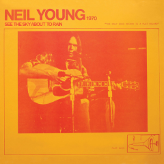
“See the Sky About to Rain” was written by Neil Young and appears as the second song on side one of Neil Young’s fifth studio album, On the Beach, which was recorded between February and April 1974 at Sunset Sound in Hollywood and Young’s Broken Arrow Ranch studio in Woodside, CA. It’s the second release of what Young calls the “Ditch Trilogy," referring to the three albums he made after the huge success of his Harvest LP. Young explained that Harvest “put me in the middle of the road. Traveling there became a bore, so I headed for the ditch. A rougher ride, but I saw more interesting people there.” Produced by Neil Young, David Briggs, Mark Harman and Al Schmitt, the album was released in July 1974. It went to #16 on the Billboard Top 200 Albums chart and has been certified Gold by the Recording Industry Association of America. One single, “Walk On,” was released from the LP. At the time of its release Rolling Stone magazine described it as “one of the most depressing albums of the decade.” Personnel on the record were: Neil Young (vocals, guitar, harmonica, Wurlitzer electric piano through vintage Magnatone amp), Ben Keith (steel guitar), Tim Drummond (bass), and Levon Helm (drums).
Neil Young is a Canadian singer, songwriter, musician and filmmaker. He embarked on his music career in Winnipeg before arriving in Los Angeles in 1966. There he joined his friend Stephen Stills in forming the band, Buffalo Springfield. His career reached new heights when he was a member of Crosby, Stills, Nash and Young. His solo career, often backed up by the band, Crazy Horse, has yielded several best-selling albums. As a solo artist, Young has released 41 studio albums, 12 live albums, three compilation albums, two EPs, four soundtrack albums and 61 singles. He released two studio albums and nine singles as a member of Buffalo Springfield. As a member of Crosby, Stills, Nash and Young, he released two studio albums, one live album, two compilation albums and four singles. He has won three Grammy Awards and one MTV Video Music Award, and was inducted into the Rock and Roll Hall of Fame twice, first in 1995 as a solo artist and again in 1997 as a member of Buffalo Springfield. Young has sold more than 75 million records worldwide. He continues to record and tour.