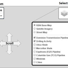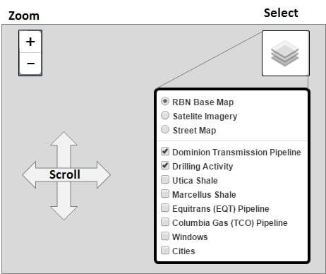
If you have other questions about how to use the mapping capability, click on the link in the bottom right corner Map Help.
This map highlights all of the Northeast infrastructure covered in this Drill Down Report, Join Together with Demand. Similar to all the Pipeline GIS maps in this series, you can toggle on and off all the infrastruce including the two producing blobs (NE PA and SE PA/WV/OH), the Marcellus and Utica shale regions described in Part 1, and the Crude/NGL/gas windows described in Part 2. All of these can be superimposed on the RBN base map, satellite imagery or a street map with cities. If you have questions or comments, please direct them to [email protected].